

Best Hiking Trails in Mindanao: 30 Mountains and Nature Treks Every Outdoor Enthusiast Should Explore
Best Hiking Trails in Mindanao offer some of the most breathtaking trekking experiences in the Philippines, with routes that pass through mountains, forests, ridgelines, and river valleys. A hiking trail is a marked or established path through natural terrain designed for walking, trekking, or mountaineering rather than vehicle travel. Trails can range from a short, paved nature walk to a multi-day route across volcanic peaks and mossy cloud forests. In the Philippines, hiking (often called “climbing” by local mountaineers, regardless of technical difficulty) has grown into one of the country’s most popular outdoor pursuits, and Mindanao sits at the very center of that scene.
Mindanao is the second-largest island in the Philippines, and it is home to the country’s tallest mountain, its widest waterfall, its most biodiverse UNESCO World Heritage Site, and several of its highest and most technically demanding peaks. Unlike Luzon or the Visayas, Mindanao’s interior is dominated by vast, largely unspoiled mountain ranges — the Kitanglad Range, the Kalatungan Range, the Diwata Mountains, the Apo–Talomo Range — that rise straight out of farmland and rainforest, often still managed by the indigenous communities who have lived on them for generations.
The island’s landscapes are remarkably varied. Within a few hours of each other, hikers can find dormant and active volcanoes with crater lakes, cloud forests draped in centuries-old moss, cascading multi-tier waterfalls, a UNESCO-listed pygmy forest sanctuary, and sacred limestone peaks that double as pilgrimage sites. This diversity means Mindanao has something for nearly every kind of outdoor enthusiast — from a family looking for an easy nature walk with a view, to a seasoned mountaineer chasing the “Philippine Ultras,” the country’s highest peaks.
Because trails vary so widely in difficulty, this guide organizes Mindanao’s best hiking destinations by mountain, region, and experience level, so beginners, intermediate hikers, and experienced climbers can all find a route that matches their fitness and preparation. Along the way, we’ll cover practical hiking tips, permit and guide requirements, safety reminders, and — because tourism in these areas depends heavily on the communities that host it — the local business opportunities that hiking tourism creates for guides, homestays, transport operators, and small entrepreneurs across the region.
Key Takeaways
- Mindanao is home to Mount Apo, the highest mountain in the Philippines, along with several of the country’s other tallest peaks, including Mount Dulang-Dulang and Mount Kitanglad.
- Hiking trails on the island range from easy, family-friendly nature walks to grueling multi-day mountain expeditions that require technical skill and stamina.
- Proper preparation — including permits, local guides, and appropriate gear — is essential, since many Mindanao trails pass through protected areas, ancestral domains, or active volcanic zones.
- Supporting local guides, porters, and indigenous communities is central to sustainable, respectful tourism on the island’s mountains.
- Hiking tourism fuels local economies through homestays, transportation services, equipment rentals, guiding cooperatives, and food and souvenir businesses in trailhead towns.
Table of Contents
Why Hike in Mindanao?
Diverse Mountain Landscapes
Mindanao’s terrain was shaped largely by volcanism, which is why so many of its best-known peaks — Apo, Kalatungan, Musuan, Hibok-Hibok, Melibengoy — are dormant or active volcanoes. Alongside these are non-volcanic ranges like the limestone spine of the Kitanglad Range and the ancient massif of the Diwata Mountains. This mix produces an unusually wide variety of hiking experiences packed into one island: grassland ridgelines, boulder fields, crater lakes, and dense mossy forest can all be found within a day’s drive of one another.
Rich Biodiversity
Mindanao’s mountains are part of the Eastern Mindanao Biodiversity Corridor, one of the most species-rich regions in the Philippines. The island hosts the Philippine eagle, the world’s largest eagle species and one of the rarest raptors on Earth, along with numerous endemic pitcher plants, orchids, frogs, and mammals found nowhere else. Protected areas such as the Mount Hamiguitan Range Wildlife Sanctuary (a UNESCO World Heritage Site) and the Mount Kitanglad and Kalatungan natural parks exist specifically to safeguard this biodiversity, and hikers who visit responsibly become part of that conservation story.
Scenic Views and Sunrise Peaks
Many of Mindanao’s trails are built around a sunrise payoff — camping overnight near a summit or ridge so hikers can watch the sun rise over a sea of clouds, neighboring peaks, or coastal plains. Mount Kulago’s “Hummingbird Ridge,” Mount Capistrano’s rock-strewn summit, and Mount Kiamo’s mossy-forest viewpoint are all popular specifically for this experience, and it’s a major draw for photographers and casual hikers alike.
Adventure Tourism Opportunities
Beyond traditional mountain climbs, Mindanao has developed a strong adventure tourism infrastructure: the Seven Falls zipline in Lake Sebu (billed as one of the highest in Southeast Asia), the Dahilayan Forest and Adventure Park in Bukidnon (home to Asia’s longest dual zipline), and eco-parks like Eden Nature Park near Davao City. These sites give visitors an accessible entry point into Mindanao’s outdoors before — or instead of — tackling a full mountain climb.
Supporting Local Communities
Most of Mindanao’s major hiking destinations sit within ancestral domains belonging to Lumad groups such as the Manobo, Talaandig, Bagobo, Higaonon, Subanon, and T’boli, or within Muslim communities in the Bangsamoro region, as with Bud Bongao and Bud Tumantangis. Guide fees, environmental fees, and porter services are often the primary source of income tourism brings to these communities, which is why hiring local guides isn’t just a safety requirement — it’s a direct way to support the people who steward these mountains.
Things to Know Before Hiking in Mindanao
Best Time to Hike
The dry season, generally from November to May, offers the most reliable hiking conditions across most of Mindanao, with December to May typically recommended for higher, more technical peaks like Mount Apo, Mount Kalatungan, and Mount Dulang-Dulang, where trails become dangerously slippery in the rains. Some protected areas, including Mount Apo Natural Park, are officially closed to hikers for part of the year (Mount Apo closes from June 1 to August 31) to allow the ecosystem to recover and to reduce risk during the wettest months. Always check current closure dates with the managing DENR office or local tourism office before planning a trip, since these can shift from year to year.
Difficulty Ratings
Philippine mountaineers commonly rate climbs on a scale from roughly 1 (very easy, a walk in the park) to 9 (extremely technical, multi-day, expedition-level). Trail-tracking platforms like AllTrails instead classify trails as easy, moderate, or hard based on distance, elevation gain, and terrain. This guide uses a simplified beginner / intermediate / advanced / multi-day expedition framework, but always check the specific difficulty rating and trip reports from a recent climb before committing, since trail conditions can change after storms, landslides, or maintenance work.
Permits and Registration
Nearly every named mountain in this guide sits within a protected area, natural park, or ancestral domain, which means registration — and often a paid permit — is required before hiking. Popular protected sites like Mount Apo Natural Park, Mount Kitanglad and Kalatungan Range Natural Park, Mount Hamiguitan Range Wildlife Sanctuary, and the Timpoong and Hibok-Hibok Natural Monument in Camiguin are managed jointly by the DENR, the local Protected Area Management Board (PAMB), and the municipal or city tourism office. Registration typically happens at a municipal hall, tourism office, or barangay hall near the trailhead, and fees usually cover an environmental fee, a guide fee, and sometimes a campsite fee.
Hiring Local Guides
Guides are mandatory on the overwhelming majority of Mindanao’s trails, and for good reason: many routes cross unmarked jungle, river crossings, or ancestral land where local knowledge is essential for both safety and cultural respect. Even on the handful of trails where a guide isn’t strictly required, hiring one is strongly recommended and directly supports the community that maintains the trail.
Essential Hiking Gear
At minimum, pack a well-fitted daypack or backpack, broken-in trekking shoes with good ankle support, quick-dry clothing, a rain jacket, a headlamp with spare batteries, a basic first aid kit, more water than you think you’ll need, high-energy food, and a whistle. For overnight climbs, add a tent or ask your guide about shared shelters, a sleeping bag rated for cold mountain nights (temperatures on peaks like Kitanglad and Dulang-Dulang regularly drop into single digits Celsius), and a portable stove if cooking on the trail.
Safety Reminders
Always register with local authorities before starting a climb, hike with a licensed guide, inform someone outside your group of your itinerary and expected return time, check the weather forecast in the days leading up to your climb, and turn back if conditions deteriorate. Several of Mindanao’s peaks — Hibok-Hibok, Musuan, Kalatungan, Melibengoy, and Apo among them — are active or potentially active volcanoes, and hikers should follow all posted advisories from PHIVOLCS (the Philippine Institute of Volcanology and Seismology).
Leave No Trace Principles
Carry out everything you carry in, stay on marked trails to avoid damaging fragile mossy forest and endemic plant life, avoid disturbing wildlife, respect sacred sites and indigenous customs (some summits, like Bud Bongao and Mount Apo, hold deep spiritual significance for local communities), and never remove plants, rocks, or artifacts from protected areas.
30 Best Hiking Trails in Mindanao
1. Mount Apo (Davao del Sur, Davao City, and Cotabato)
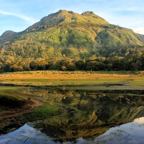
- Trail Overview: The Philippines’ highest and most iconic climb, Mount Apo is a dormant stratovolcano revered by Lumad groups as Apo Sandawa. The most popular routes are the Sta. Cruz Trail (Davao del Sur), the Kidapawan-Magpet Trail (Cotabato), and the Kapatagan Trail, each offering a different mix of river crossings, boulder scrambling, and mossy forest.
- Difficulty Level: Difficult (multi-day, technical in sections such as the Boulder Face).
- Elevation: 2,954 meters (9,692 ft) above sea level — the highest peak in the Philippines.
- Estimated Hiking Time: 2 to 3 days, 1 to 2 nights, typically camping at Lake Venado.
- Highlights: Lake Venado campsite, sulfur vents, boulder fields, sweeping summit views, frequent Philippine eagle sightings, wild orchids and pitcher plants.
- Best Time to Visit: November to May; the park is officially closed to climbers from June 1 to August 31 each year.
2. Mount Dulang-Dulang (Bukidnon)
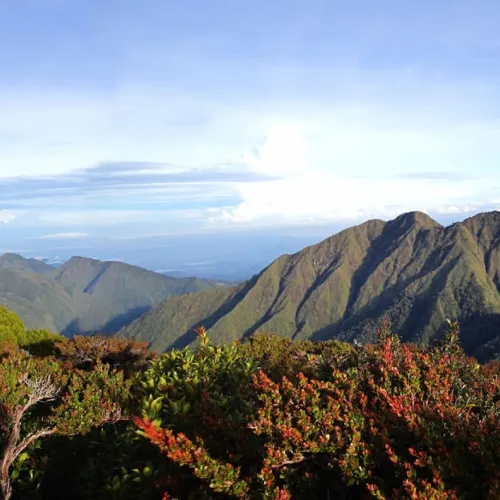
- Trail Overview: Known to Filipino mountaineers as “D2,” Dulang-Dulang is the second-highest mountain in the Philippines and the highest point in the Kitanglad Mountain Range. It is considered sacred by the Talaandig people, and the standard route follows the Bol-ogan Trail from Sitio Bol-ogan, Barangay Songco, in the municipality of Lantapan.
- Difficulty Level: Difficult (high elevation, cold nights, extended mossy-forest sections).
- Elevation: 2,941 meters (9,649 ft) above sea level.
- Estimated Hiking Time: 2 days, 1 night (often combined with a Kitanglad traverse for a longer expedition).
- Highlights: Ancient mossy forest, rich birdlife, panoramic views of Mount Apo and Mount Kitanglad, cultural significance to the Talaandig people.
- Best Time to Visit: December to May, avoiding the wettest months.
3. Mount Kitanglad (Bukidnon)
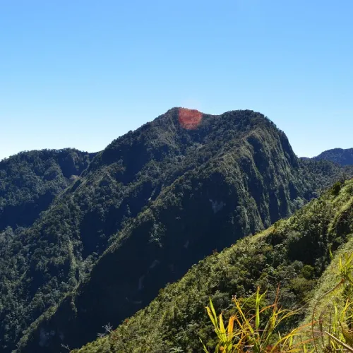
- Trail Overview: An inactive volcano and the fourth-highest peak in the Philippines, Mount Kitanglad anchors the Kitanglad Mountain Range and the protected Mount Kitanglad Range Natural Park, an ASEAN Heritage Park. The usual jump-off is near Intavas or La Fortuna in Impasug-ong.
- Difficulty Level: Difficult (steep, extended climb through primary and mossy forest).
- Elevation: 2,899 meters (9,511 ft) above sea level.
- Estimated Hiking Time: 2 days, 1 night for most groups.
- Highlights: Old-growth and mossy forest, endemic wildlife, protected biodiversity corridor, views across central Bukidnon.
- Best Time to Visit: Dry season, December to May.
4. Mount Kalatungan (Bukidnon)
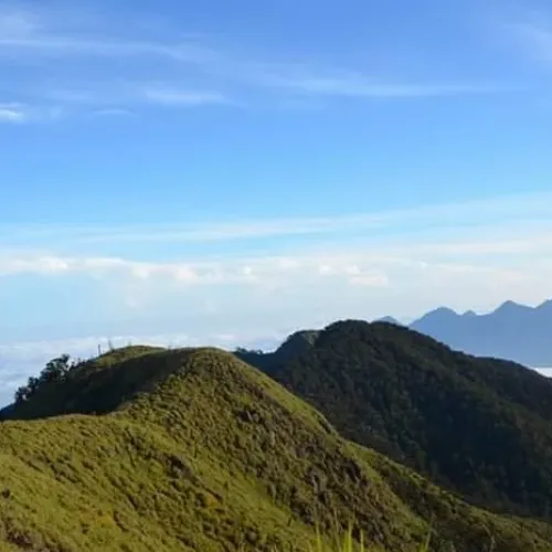
- Trail Overview: A potentially active volcano known locally as “Keretungan,” Mount Kalatungan is one of the most physically demanding climbs in Mindanao. It sits within the ancestral domain of the Manobo and Talaandig peoples, with jump-offs in Talakag, Pangantucan, Valencia, or Maramag depending on the chosen route.
- Difficulty Level: Very difficult (long approach, technical ridges, unpredictable weather).
- Elevation: Approximately 2,880 meters (9,450 ft) above sea level (also cited at 2,854–2,860 m in provincial references).
- Estimated Hiking Time: 2 to 3 days for most groups.
- Highlights: Remote old-growth and mossy forest, sweeping views of the Bukidnon plateau, rich endemic flora and fauna.
- Best Time to Visit: March to May, the driest window, to avoid slippery, muddy trails.
5. Mount Kulago (Bukidnon)
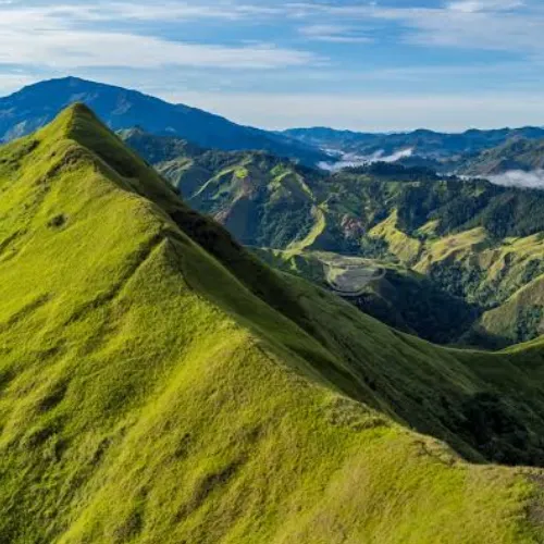
- Trail Overview: Nicknamed the “Hummingbird Mountain,” Mount Kulago in Impasug-ong is a much gentler, grassland-ridge climb best known for its sunrise views of the Kitanglad Range. The trail is roughly 90% open ridge with little shade.
- Difficulty Level: Easy to moderate (minor climb, but with significant sun exposure).
- Elevation: Approximately 913 meters (2,995 ft) above sea level.
- Estimated Hiking Time: 4 to 6.5 hours, often done as an overnight camp for the sunrise view.
- Highlights: Rolling emerald ridges, a Tagoloan River crossing, 360-degree views of the Kitanglad Range, cold nights despite the hot daytime trail.
- Best Time to Visit: Dry season; go early to avoid peak heat on the exposed ridge.
6. Mount Capistrano (Bukidnon)
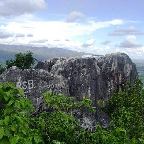
- Trail Overview: A short but steep sunrise climb near Malaybalay, popular for its rock formations, caves, and views over the Basakan rice fields.
- Province/Location: Malaybalay City, Bukidnon.
- Difficulty Level: Moderate to hard (steep scrambling near the summit).
- Elevation: A minor peak; precise official elevation is not widely published, but the climb involves roughly 1.5 miles round trip.
- Estimated Hiking Duration: 2.5 to 4 hours round trip.
- Trail Features: Rock scrambles, caves, panoramic sunrise views, day-hike friendly.
- Best Time to Visit: Early morning, dry season.
- Guide Requirement: Recommended; registration and small entrance fee required at the trailhead.
7. Mount Kiamo (Bukidnon)
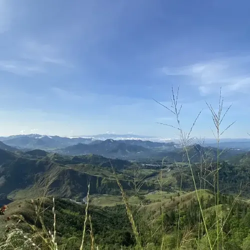
- Trail Overview: A rugged jungle trail near Malaybalay leading into high-altitude mossy forest with views of the surrounding Kitanglad peaks.
- Province/Location: Malaybalay City, Bukidnon.
- Difficulty Level: Hard (muddy, root-covered terrain).
- Elevation: Roughly 4,363 ft (1,330 m) of elevation gain over the course of the climb.
- Estimated Hiking Duration: 7 to 8 hours one way; usually done as an overnight climb.
- Trail Features: Dense jungle, mossy forest ecosystem, panoramic ridge views.
- Best Time to Visit: Dry season, December to May.
- Guide Requirement: Mandatory.
8. Mount Tago / Tagoan (Bukidnon)
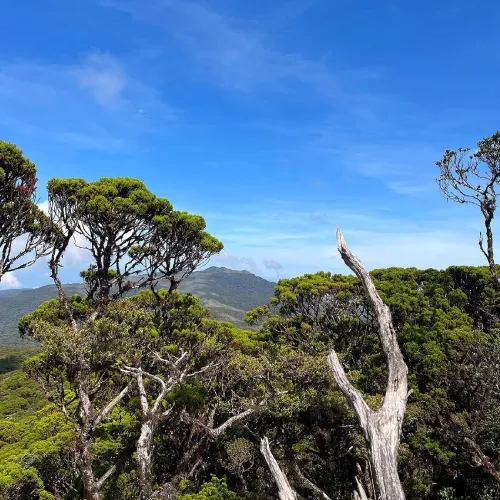
- Trail Overview: A demanding backcountry trail in Pangantucan, popular with backpackers and campers looking for a quieter alternative to the more famous Bukidnon peaks.
- Province/Location: Pangantucan, Bukidnon.
- Difficulty Level: Hard.
- Elevation: Approximately 2,424 ft (740 m) of elevation gain along the trail.
- Estimated Hiking Duration: 4.5 to 5 hours one way.
- Trail Features: Backpacking and camping trail, forested ridgelines, low foot traffic.
- Best Time to Visit: Dry season.
- Guide Requirement: Recommended; register at the barangay hall.
9. Mount Musuan (Bukidnon)
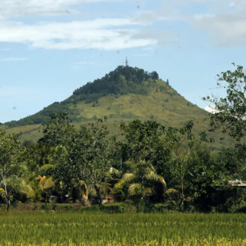
- Trail Overview: Also called Mount Calayo (“Fire Mountain”), Musuan Peak is an active lava-dome volcano that rises abruptly out of the flat Bukidnon plain in Maramag, right beside the Central Mindanao University campus.
- Province/Location: Maramag, Bukidnon.
- Difficulty Level: Easy to moderate — a compact but genuinely steep day hike.
- Elevation: 646 meters (2,119 ft) above sea level.
- Estimated Hiking Duration: 2 to 3 hours round trip.
- Trail Features: Distinctive cone-shaped isolated peak, panoramic plains views, active volcanic history (last erupted around 1886–1887).
- Best Time to Visit: Year-round, though dry season is preferred for trail footing.
- Guide Requirement: Optional but recommended for first-time visitors.
10. Mount Minandar (Misamis Occidental)
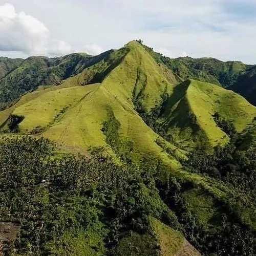
- Trail Overview: A multi-camp overnight climb in the mountainous interior above Ozamiz City, popular with local mountaineering clubs for its cold-weather test of endurance; several climbers report technical, hours-long ascents through multiple campsites before reaching the summit.
- Province/Location: Ozamiz City area, Misamis Occidental.
- Difficulty Level: Moderate to difficult, with cold overnight conditions reported near the summit.
- Elevation: No widely published official figure; climbers describe a long multi-camp ascent, suggesting a substantial elevation gain.
- Estimated Hiking Duration: Typically an overnight climb (climbers have reported ascents lasting from mid-morning into the early hours of the following day).
- Trail Features: City overlook views, forested slopes, multiple established campsites.
- Best Time to Visit: Dry season.
- Guide Requirement: Mandatory; coordinate with local mountaineering groups or the Ozamiz tourism office.
11. Mount Malindang Natural Park (Misamis Occidental)
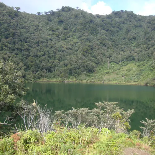
- Trail Overview: The highest peak on the entire Zamboanga Peninsula, Mount Malindang is a dormant complex volcano protected as the Mount Malindang Range Natural Park, straddling Misamis Occidental, Zamboanga del Norte, and Zamboanga del Sur. The classic route follows the North Peak Trail through Lake Duminagat, a historic crater lake, and passes through the ancestral domain of the Subanon people.
- Province/Location: Misamis Occidental (park extends into Zamboanga del Norte and Zamboanga del Sur).
- Difficulty Level: Difficult (multi-day, rugged jungle terrain).
- Elevation: 2,404 meters (7,887 ft) above sea level.
- Estimated Hiking Duration: 3 days, 2 nights via the North Peak Trail.
- Trail Features: Lake Duminagat crater lake, waterfalls, mossy and pine forest, sulfurous hot springs, Subanon cultural sites.
- Best Time to Visit: Dry season; the annual “Freedom Climb” is held in June-July.
- Guide Requirement: Mandatory; arranged through the local tourism office or mountaineering groups based in Ozamiz.
12. Mount Lumot (Bukidnon)
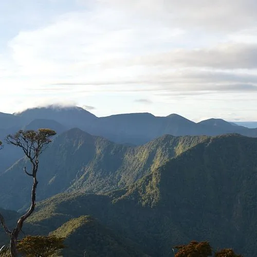
- Trail Overview: Locally known as Mount Lumpanag, this moss-covered peak near Barangay Pinagtauranan is most often climbed as part of a traverse with neighboring Mount Kalatungan, rewarding hikers with cold, cloud-wrapped summit views.
- Province/Location: Bukidnon (in the Kalatungan Mountain Range).
- Difficulty Level: Hard, with steep uphill sections.
- Elevation: Official elevation figures are not widely published; the peak sits within the Kalatungan Range’s upper mossy-forest zone.
- Estimated Hiking Duration: Typically combined with a multi-day Kalatungan traverse.
- Trail Features: Moss-draped forest, cold summit climate, panoramic mountain-range views.
- Best Time to Visit: Dry season.
- Guide Requirement: Mandatory; register at the barangay hall before starting.
13. Mount Hamiguitan (Davao Oriental)
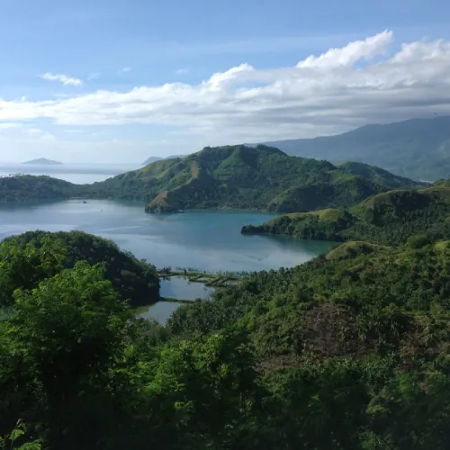
- Trail Overview: A UNESCO World Heritage Site since 2014, the Mount Hamiguitan Range Wildlife Sanctuary protects the world’s largest pygmy forest along with critically endangered pitcher plants (several found nowhere else on Earth), the Philippine eagle, and the Philippine cockatoo. Visitor numbers are capped to protect the ecosystem.
- Province/Location: San Isidro, Mati City, and Governor Generoso, Davao Oriental.
- Difficulty Level: Moderate.
- Elevation: 1,620 meters (5,315 ft) above sea level (the sanctuary spans an elevation range of roughly 75–1,637 m).
- Estimated Hiking Duration: Typically a full-day guided trek to the pygmy forest viewing areas, or longer for summit attempts.
- Trail Features: UNESCO-listed pygmy forest, pitcher plants (Nepenthes), Philippine eagle and cockatoo habitat, dipterocarp forest at lower elevations.
- Best Time to Visit: Dry season, before 10:00 a.m. to avoid crowds and heat.
- Guide Requirement: Mandatory; only a limited number of hikers are permitted at a time.
14. Mount Dinor (Davao del Sur)
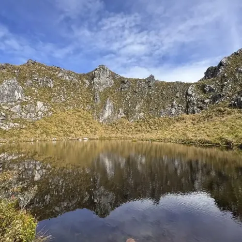
- Trail Overview: Located within the wider Mount Apo Natural Park area in Sta. Cruz, Mount Dinor is a favorite training climb for hikers preparing for Mount Apo itself, combining genuine distance and elevation gain with a comparatively accessible jump-off.
- Province/Location: Sta. Cruz, Davao del Sur.
- Difficulty Level: Hard.
- Elevation: Elevation gain of roughly 3,733 ft (1,140 m) along the trail.
- Estimated Hiking Duration: 7.5 to 8.5 hours round trip.
- Trail Features: Forested slopes, ridge views toward the Apo-Talomo Range, a popular conditioning hike for Apo aspirants.
- Best Time to Visit: Dry season.
- Guide Requirement: Recommended; coordinate with local guides in Sta. Cruz.
15. Mount Magdiwata (Agusan del Sur)
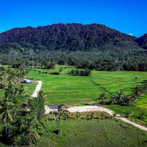
- Trail Overview: A low, wide mountain in San Francisco considered by the indigenous Manobo to be home to diwata (spirits), Mount Magdiwata is a relatively easy day hike that rewards visitors with views over the Agusan Marsh, plus streams, waterfalls, and rock pools along some of its trail variants.
- Province/Location: San Francisco, Agusan del Sur.
- Difficulty Level: Easy to moderate.
- Elevation: Approximately 567 to 592 meters above sea level.
- Estimated Hiking Duration: 2 to 3 hours for most trail variants.
- Trail Features: Wide summit plateau, Agusan Marsh views, waterfalls and rock pools, cultural/spiritual significance to the Manobo people.
- Best Time to Visit: Dry season.
- Guide Requirement: Recommended; local guides from San Francisco’s community mountaineering groups are available.
16. Mount Hilong-Hilong (Agusan del Norte)
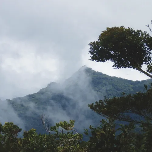
- Trail Overview: The highest peak in the Caraga Region and part of the Diwata Mountain Range, Mount Hilong-Hilong is considered one of the most technically demanding climbs in Mindanao, reached via the multi-day Malvar Trail from Cabadbaran.
- Province/Location: Cabadbaran, Agusan del Norte (spanning the boundary with Agusan del Sur and Surigao del Sur).
- Difficulty Level: Very difficult; recommended only for climbers with intermediate to expert skills.
- Elevation: 2,012 meters (6,601 ft) above sea level.
- Estimated Hiking Duration: 4 to 5 days round trip.
- Trail Features: Seven major waterfalls, ancient rock art, Philippine eagle nesting habitat, high avian biodiversity (around 120 recorded bird species).
- Best Time to Visit: Dry season, with advance arrangement given the trail’s remoteness.
- Guide Requirement: Mandatory; arranged through the Cabadbaran City tourism office.
17. Mount Agad-Agad (Lanao del Norte)
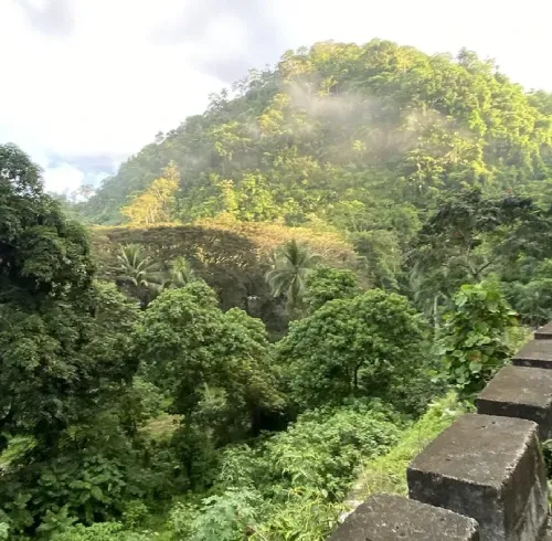
- Trail Overview: A highly accessible mountain within Iligan City itself, popular for both day hikes and overnight camping, with a small waterfall along the way and sweeping night views of the city.
- Province/Location: Iligan City, Lanao del Norte.
- Difficulty Level: Easy to moderate.
- Elevation: 490 meters (1,610 ft) above sea level.
- Estimated Hiking Duration: 2 to 4 hours, or overnight for camping.
- Trail Features: City overlook views, a small waterfall en route, easy access from Iligan’s Poblacion area.
- Best Time to Visit: Year-round; dry season for the best views.
- Guide Requirement: Optional, though a local guide is helpful for first-time visitors.
18. Mount Mambajao (Camiguin)
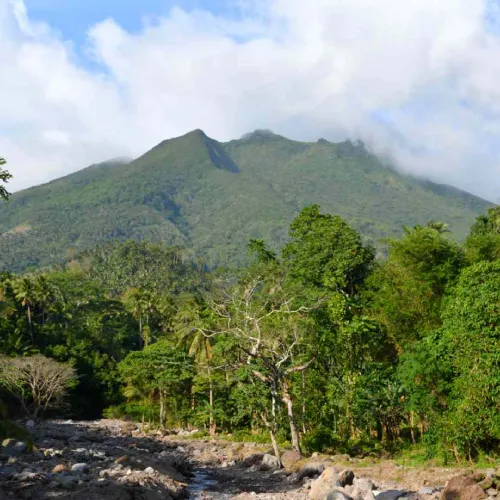
- Trail Overview: The central and largest of Camiguin’s volcanic mountains, Mount Mambajao includes Mount Timpoong — the island’s highest point — among its several summits, all protected within the Timpoong and Hibok-Hibok Natural Monument, an ASEAN Heritage Park.
- Province/Location: Mambajao, Camiguin.
- Difficulty Level: Difficult; portions of the reserve have restricted access to protect biodiversity.
- Elevation: The Mambajao massif reaches roughly 1,552–1,568 meters at its secondary peaks.
- Estimated Hiking Duration: Varies by permitted route; full traverses require multiple days.
- Trail Features: Dense forest, endemic species found nowhere else on Camiguin, panoramic island and sea views.
- Best Time to Visit: Dry season; confirm current access rules with DENR before planning.
- Guide Requirement: Mandatory, with DENR/protected-area permits required.
19. Mount Hibok-Hibok (Camiguin)

- Trail Overview: Camiguin’s only currently active volcano and one of its most popular hikes, Mount Hibok-Hibok is typically climbed via the Itum Trail or from the Ardent Hot Spring area, passing through forest to a crater-lake campsite before the final summit push.
- Province/Location: Catarman, Camiguin.
- Difficulty Level: Moderate to difficult.
- Elevation: 1,332 meters (4,370 ft) above sea level.
- Estimated Hiking Duration: 6 to 8 hours one way (roughly 10.6 km).
- Trail Features: Crater lake campsite, hot springs at the trailhead, sweeping views of Camiguin’s coastline and neighboring White Island.
- Best Time to Visit: Dry season; check current volcanic activity advisories from PHIVOLCS before climbing.
- Guide Requirement: Mandatory; permits issued through the DENR protected-area office.
20. Mount Timpoong (Camiguin)
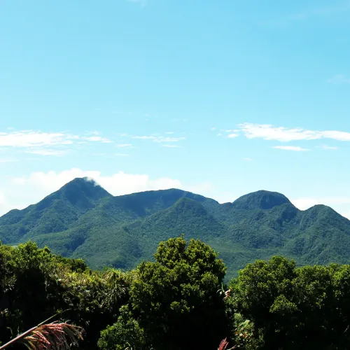
- Trail Overview: At 1,614 meters, Mount Timpoong is the highest point on Camiguin Island and, together with Hibok-Hibok, anchors the Timpoong and Hibok-Hibok Natural Monument. Access to the summit itself is tightly restricted to protect its unique ecosystem, including the endemic Camiguin forest mouse and Camiguin hanging parrot.
- Province/Location: Camiguin (spanning Mambajao, Catarman, Mahinog, and Sagay).
- Difficulty Level: Difficult; recreational summit access is limited.
- Elevation: 1,614 meters (5,295 ft) above sea level.
- Estimated Hiking Duration: Varies; largely restricted to scientific or specially permitted expeditions.
- Trail Features: Katibawasan and Tuasan waterfalls within the wider reserve, dense forest, rare endemic wildlife.
- Best Time to Visit: Dry season, contingent on permitted access.
- Guide Requirement: Mandatory, subject to DENR approval.
21. Bud Bongao (Tawi-Tawi)
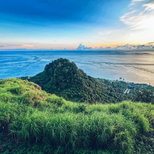
- Trail Overview: The southernmost named peak in the Philippines, Bud Bongao is a sacred limestone mountain formed of six peaks, considered a spiritual and pilgrimage site for both Muslim and Christian visitors. A cobblestone path with over 3,600 steps leads to the main viewpoint, and long-tailed macaques are common along the route.
- Province/Location: Bongao, Tawi-Tawi.
- Difficulty Level: Easy to moderate.
- Elevation: Approximately 314 to 342 meters (1,030–1,122 ft) above sea level.
- Estimated Hiking Duration: 1 to 2 hours round trip.
- Trail Features: Sacred Islamic tombs (tampat), panoramic views of Bongao town and neighboring islands, resident macaque population.
- Best Time to Visit: Early morning, year-round; the site is open daily.
- Guide Requirement: Not strictly required on the main path, though respect for sacred sites is essential.
22. Bud Tumantangis (Sulu)
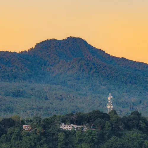
- Trail Overview: The highest point on Jolo Island, Bud Tumantangis is a culturally significant peak with a short, steep trail. Given the security situation in parts of Sulu province, hikers should coordinate closely with local authorities and check current travel advisories before planning a visit.
- Province/Location: Jolo, Sulu.
- Difficulty Level: Moderate (short but steep).
- Elevation: 811 meters (2,660 ft) above sea level.
- Estimated Hiking Duration: Varies by route; generally a shorter climb than the island’s headline peaks.
- Trail Features: Cultural and historical significance, panoramic views over Jolo.
- Best Time to Visit: Dry season, subject to current local security conditions.
- Guide Requirement: Mandatory, with local coordination essential.
23. Lake Holon Trek (South Cotabato)
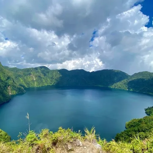
- Trail Overview: Known as the “Crown Jewel of the South,” Lake Holon (also called Lake Maughan) is a striking crater lake sitting atop Mount Melibengoy (formerly Mount Parker), a dormant stratovolcano sacred to the T’boli people. Two main trails lead to the crater rim and lakeside campsite: the gentler Salacafe Trail and the steeper Kule Trail.
- Province/Location: T’Boli, South Cotabato.
- Difficulty Level: Moderate (Salacafe Trail) to difficult (Kule Trail).
- Elevation: The lake sits within the crater at roughly 1,300–1,800 meters, with Mount Melibengoy’s summit reaching approximately 1,824 meters above sea level.
- Estimated Hiking Duration: 2 to 6 hours one way, depending on the trail chosen.
- Trail Features: Crater lake campsite, canoeing, panoramic Kule View Deck, T’boli cultural immersion; the lake has previously been recognized for having some of the cleanest inland water in the Philippines.
- Best Time to Visit: Dry season, November to May.
- Guide Requirement: Mandatory; register at the T’Boli Municipal Tourism Office.
24. Seven Falls Eco Trail (South Cotabato)
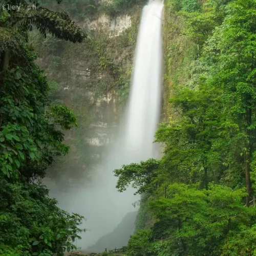
- Trail Overview: Located in Lake Sebu, the “Summer Capital of Southern Mindanao,” Seven Falls is a series of seven T’boli-named waterfalls fed by Lake Sebu and Lake Siloton. Most visitors combine a short walking trail to the first two falls with a zipline ride — reportedly one of the highest in Southeast Asia — that passes directly over several of the cascades.
- Province/Location: Lake Sebu, South Cotabato.
- Difficulty Level: Easy (walking trail); the zipline adds an adventure element for thrill-seekers.
- Elevation: Lake Sebu township sits at roughly 1,000 meters above sea level.
- Estimated Hiking Duration: 1 to 3 hours for the accessible falls and viewpoints.
- Trail Features: Seven named waterfalls, dual-cable zipline over the falls, T’boli weaving and cultural displays nearby.
- Best Time to Visit: Dry season for the best trail conditions and photography.
- Guide Requirement: Not required for the main trail; zipline operators provide safety staff.
25. Aliwagwag Falls Eco Trail (Davao Oriental)
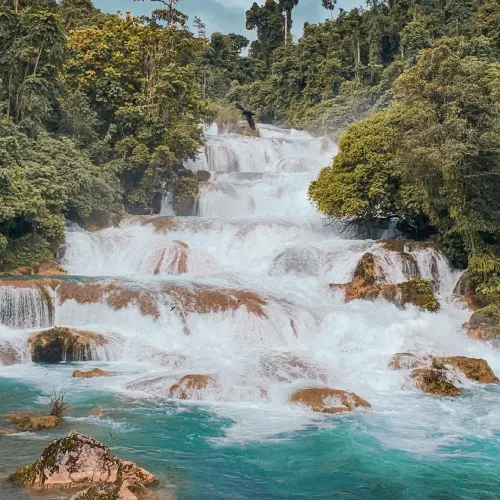
- Trail Overview: Often cited as one of the tallest multi-tier waterfalls in the Philippines, Aliwagwag Falls in Cateel cascades down dozens of stair-like rock tiers. The falls were damaged by Typhoon Pablo in 2012 but have since recovered and reopened to visitors.
- Province/Location: Cateel, Davao Oriental.
- Difficulty Level: Easy to moderate.
- Elevation gain: A short, well-maintained trail leads to the main viewing area; total waterfall height is reported at roughly 340 meters (1,110 ft) across its many tiers.
- Estimated Hiking Duration: 30 minutes to 1 hour to the main viewpoint.
- Trail Features: Multi-tiered cascades, swimming pools, jungle trekking, picnic areas.
- Best Time to Visit: Dry season, when water flow is clear and trails are less slippery.
- Guide Requirement: Not required for the main viewing trail; recommended for deeper exploration.
26. Tinuy-an Falls Nature Trail (Surigao del Sur)
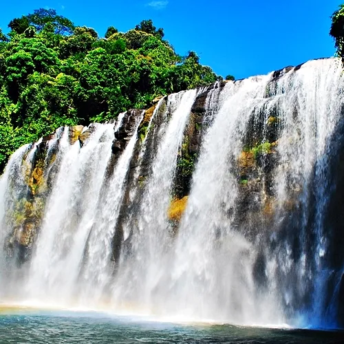
- Trail Overview: Dubbed the “Little Niagara Falls of the Philippines,” Tinuy-an Falls in Bislig City is the widest waterfall in the country, with a broad, curtain-like cascade managed jointly by the Bislig tourism office and the Manobo Tribal Council.
- Province/Location: Barangay Burboanan, Bislig City, Surigao del Sur.
- Difficulty Level: Easy.
- Elevation: The falls drop about 55 meters (180 ft) and span roughly 95 meters (312 ft) in width.
- Estimated Hiking Duration: Under an hour to explore the main viewing areas and tiers.
- Trail Features: Bamboo rafting close to the base, a rainbow that typically appears between 9 and 11 a.m., multi-tiered viewing platforms.
- Best Time to Visit: Morning visits for the rainbow effect; dry season for the clearest water.
- Guide Requirement: Not required; rafting operators and guides are available on-site.
27. Asik-Asik Falls Trek (North Cotabato)
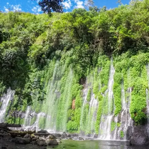
- Trail Overview: A geological rarity, Asik-Asik Falls emerges directly from cracks in a curved rock wall rather than from a single stream source, believed to be fed by an underground aquifer connected to Mount Ragang. Reaching it involves a walk through farmland and rice paddies followed by a descent on stairs into the ravine.
- Province/Location: Alamada, North Cotabato.
- Difficulty Level: Moderate (due to the descent and return climb).
- Elevation: The falls are roughly 60 meters (197 ft) high and 130–140 meters (427–460 ft) wide.
- Estimated Hiking Duration: 1 to 2 hours round trip.
- Trail Features: Curtain-like spring-fed cascade, lush fern and moss-covered rock face, swimming area at the base.
- Best Time to Visit: Dry season for the clearest water and easiest footing.
- Guide Requirement: Recommended; local guides are available at the barangay entrance.
28. Dahilayan Forest Trails (Bukidnon)
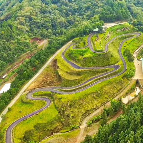
- Trail Overview: Set in the cool pine highlands of Manolo Fortich, Dahilayan Forest Park and its neighboring Adventure Park combine gentle nature trails with adrenaline attractions, most famously Asia’s longest dual zipline.
- Province/Location: Manolo Fortich, Bukidnon.
- Difficulty Level: Easy (walking trails); optional adventure activities add intensity.
- Elevation: Approximately 4,700 feet (1,430 m) above sea level.
- Estimated Hiking Duration: A few hours to a full day, depending on activities chosen.
- Trail Features: Pine forest walking trails, an 840-meter dual zipline, forest luge, hanging bridges, cool mountain climate similar to Baguio.
- Best Time to Visit: Year-round; the cool climate is especially pleasant during the dry season.
- Guide Requirement: Not required for the nature trails; park staff supervise all adventure rides.
29. Eden Nature Park Trails (Davao City)
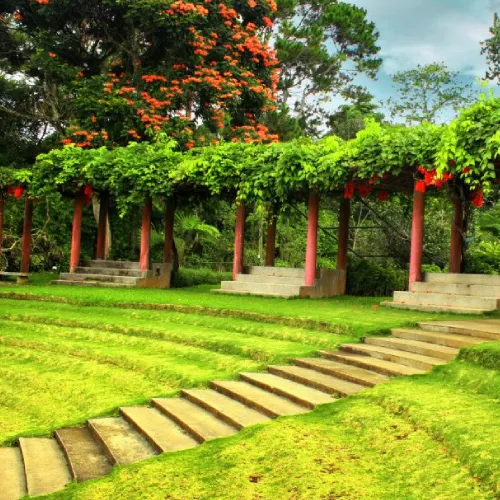
- Trail Overview: A highland eco-park and resort in the Toril district, Eden Nature Park offers an easy introduction to Mindanao’s cooler mountain climate without the commitment of a full mountain climb, with garden walks, forest trails, and adventure activities set among pine trees.
- Province/Location: Toril District, Davao City.
- Difficulty Level: Easy.
- Elevation: Situated in the highland foothills near the Mount Apo Natural Park area, with a notably cooler climate than lowland Davao City.
- Estimated Hiking Duration: 1 to 3 hours for the garden and forest trails.
- Trail Features: Garden walks, zipline and adventure rides, cool mountain air, family-friendly accommodations.
- Best Time to Visit: Year-round.
- Guide Requirement: Not required; the park is self-guided with staff support for activities.
30. Mount Sinaka (North Cotabato)
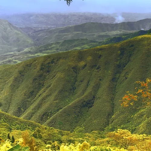
- Trail Overview: A biodiversity hotspot in the Arakan Valley, Mount Sinaka protects one of the last significant forest fragments in the area, home to dozens of endemic orchid and frog species. The trail starts near Datu Ladayon High School and follows the Ayo River toward the forested summit.
- Province/Location: Arakan, North Cotabato.
- Difficulty Level: Moderate.
- Elevation: 1,471 meters (4,826 ft) above sea level.
- Estimated Hiking Duration: Roughly 3 hours round trip.
- Trail Features: Mossy forest above 1,200 meters, rich orchid and amphibian biodiversity, riverside sections along the Ayo River.
- Best Time to Visit: Dry season.
- Guide Requirement: Recommended; register with local authorities before the climb.
Best Hiking Trails by Experience Level
Beginner-Friendly Hiking Trails
Beginners will find the most comfortable starting points in short, well-marked trails with minimal elevation gain and reliable footing. Mount Musuan, Mount Agad-Agad, Bud Bongao, Mount Magdiwata, and the walking sections of Seven Falls, Tinuy-an Falls, Aliwagwag Falls, Dahilayan Forest Park, and Eden Nature Park are all approachable for first-time hikers, families, or anyone easing into the outdoors.
Intermediate Hiking Trails
Once basic fitness and trail experience are established, hikers can move on to longer day hikes or short overnights with moderate elevation gain, such as Mount Kulago, Mount Capistrano, Mount Sinaka, Mount Dinor, Mount Tago, Asik-Asik Falls, and the Salacafe route to Lake Holon.
Advanced Mountain Climbs
Experienced hikers ready for technical terrain, higher elevation, and longer single-push days should look at Mount Kiamo, Mount Minandar, Mount Hibok-Hibok, and the Kule Trail to Lake Holon, all of which demand solid conditioning and, in some cases, cold-weather preparation.
Multi-Day Expeditions
The most serious undertakings on this list — requiring multi-day itineraries, technical skill, and full expedition planning — are Mount Apo, Mount Dulang-Dulang, Mount Kitanglad, Mount Kalatungan, Mount Malindang, Mount Hilong-Hilong, and restricted-access climbs on Mount Mambajao/Timpoong. These are best attempted only after building experience on shorter Mindanao climbs.
Best Hiking Destinations by Province
Bukidnon
Bukidnon is Mindanao’s mountaineering heartland, home to Mount Dulang-Dulang, Mount Kitanglad, Mount Kalatungan, Mount Kulago, Mount Capistrano, Mount Kiamo, Mount Tago, Mount Musuan, Mount Lumot, and Dahilayan Forest Park — an extraordinary concentration of peaks and trails within a single province.
Davao Region
Anchored by Mount Apo itself, the Davao Region also offers Mount Hamiguitan (Davao Oriental), Mount Dinor (Davao del Sur), Aliwagwag Falls (Davao Oriental), and Eden Nature Park (Davao City), making it one of the most accessible regions for combining a headline climb with easier nature attractions.
Camiguin
The “Island Born of Fire” packs Mount Hibok-Hibok, Mount Timpoong, and Mount Mambajao into one small, volcanic island, all protected within the Timpoong and Hibok-Hibok Natural Monument.
South Cotabato
South Cotabato is home to two of Mindanao’s most photographed natural attractions: Lake Holon atop Mount Melibengoy, and the Seven Falls of Lake Sebu, both deeply tied to T’boli culture and tourism.
Surigao Region
Surigao del Sur offers Tinuy-an Falls, the widest waterfall in the Philippines, while neighboring Agusan del Norte contributes Mount Hilong-Hilong, the Caraga region’s highest and most technically demanding peak, with Mount Magdiwata in nearby Agusan del Sur.
Misamis Region
Misamis Occidental is home to Mount Malindang and Mount Minandar, while Misamis Oriental contributes additional peaks in the wider Kitanglad and Balatukan mountain systems that border Bukidnon.
BARMM (Bangsamoro Region)
In the Bangsamoro Autonomous Region in Muslim Mindanao, Bud Bongao in Tawi-Tawi and Bud Tumantangis in Sulu offer culturally rich, sacred-mountain hiking experiences unlike anywhere else in the country, alongside North Cotabato’s Mount Sinaka and Asik-Asik Falls in the wider Cotabato area.
What to Pack for a Mindanao Hiking Trip
Hiking Backpack
A well-fitted 30–50 liter backpack for day hikes, or a larger overnight/expedition pack with a rain cover for multi-day climbs like Mount Apo or Mount Kalatungan.
Trekking Shoes
Broken-in, sturdy trekking or hiking shoes with good ankle support and grip; many Mindanao trails involve river crossings, mud, and loose volcanic rock.
Lightweight Clothing
Quick-dry shirts and pants, moisture-wicking socks, and a change of dry clothes for camp; avoid cotton, which stays wet and cold.
Rain Gear
A reliable rain jacket or poncho and a dry bag or pack liner — Mindanao’s mountain weather can shift quickly, even in the dry season.
First Aid Kit
Basic supplies including bandages, blister treatment, antiseptic, pain relievers, any personal medication, and a knowledge of basic first aid procedures.
Food and Water
More water than you expect to need, electrolyte supplements, and high-energy trail food; check with your guide about water refill points along the trail.
Navigation Tools
A physical map or downloaded offline GPS trail, a compass or GPS device as backup, and a fully charged phone — though signal is unreliable to nonexistent on most Mindanao summits.
Emergency Essentials
A headlamp with spare batteries, a whistle, a multi-tool, a lighter or fire starter, and an emergency blanket, especially for overnight and multi-day climbs.
Hiking Safety Tips
Check the Weather Forecast
Monitor forecasts in the days leading up to your climb and be prepared to reschedule if heavy rain, typhoon activity, or volcanic alerts are in effect.
Register Before Hiking
Always register at the designated municipal hall, tourism office, or barangay hall, and pay any required permit or environmental fees before starting your hike.
Stay on Designated Trails
Straying from marked trails increases the risk of getting lost, damages fragile mossy-forest ecosystems, and can disturb sacred or environmentally sensitive sites.
Respect Indigenous Communities
Many Mindanao mountains sit on ancestral domain land; follow your guide’s instructions regarding sacred sites, customs, and any restrictions on photography or behavior.
Practice Leave No Trace
Pack out all trash, avoid single-use plastics where possible, and leave plants, rocks, and wildlife undisturbed.
Know Your Physical Limits
Choose a trail that matches your actual fitness and experience level, build up gradually from easier climbs, and don’t hesitate to turn back if conditions or your own condition change for the worse.
Business Opportunities Around Hiking Tourism
Guided Hiking Tours
Local guiding cooperatives and individual DENR-accredited guides earn income leading climbers through protected areas, sharing ecological and cultural knowledge along the way.
Homestays and Lodging
Trailhead towns from T’Boli to Cabadbaran benefit from family-run homestays, guesthouses, and lodges that host hikers before and after their climbs.
Camping Equipment Rental
Tents, sleeping bags, cooking gear, and headlamps are frequently rented locally, creating opportunities for small equipment-rental businesses near popular jump-off points.
Outdoor Adventure Shops
Towns near major trailheads support demand for trekking poles, rain gear, footwear, and last-minute supplies, particularly in cities like Davao, Cagayan de Oro, and Malaybalay.
Local Food and Souvenir Businesses
Trailside sari-sari stores, packed-lunch vendors, and souvenir stalls selling woven T’boli or Talaandig crafts all benefit directly from hiking tourism traffic.
Transportation Services
Habal-habal (motorcycle taxi) drivers, tricycle operators, and van or bus services connecting towns to remote trailheads form an essential — and often locally owned — part of the hiking economy.
Eco-Tourism and Community-Based Tourism
Protected areas like Mount Hamiguitan, Mount Kitanglad, and Mount Malindang increasingly rely on community-based tourism models, where indigenous communities manage guiding, lodging, and conservation programs together, keeping tourism revenue within the local economy.
Frequently Asked Questions
What is the best hiking trail in Mindanao?
There’s no single “best” trail — it depends on your goals. For bragging rights and a bucket-list challenge, Mount Apo is the clear choice as the Philippines’ highest peak. For scenery with less commitment, Lake Holon and the Seven Falls of Lake Sebu are consistently rated among the island’s most rewarding destinations for the effort involved.
Which mountain is the highest in Mindanao?
Mount Apo, at 2,954 meters (9,692 ft), is the highest mountain in Mindanao and in the entire Philippines. Mount Dulang-Dulang (2,941 m) and Mount Kitanglad (2,899 m), both in Bukidnon, rank close behind as the second- and fourth-highest peaks in the country.
Are there beginner-friendly hiking trails in Mindanao?
Yes. Trails like Mount Musuan, Mount Agad-Agad, Bud Bongao, Mount Magdiwata, and the accessible sections of Seven Falls, Tinuy-an Falls, and Aliwagwag Falls are well-suited to beginners, families, and casual hikers.
Do I need a guide to hike in Mindanao?
For the vast majority of Mindanao’s mountains, yes — a local guide is either legally required or strongly recommended, since most trails pass through protected areas or ancestral domain land where local knowledge is essential for both safety and cultural respect.
What is the best time to hike in Mindanao?
The dry season, roughly November through May, offers the most reliable trail conditions across the island. Some protected areas, like Mount Apo Natural Park, are officially closed to hikers during part of the wet season (June 1 to August 31), so always confirm current access rules before planning your trip.
How much does it cost to hike Mount Apo?
Costs vary by trail and operator, but climbers should generally budget for a climbing permit, an environmental fee, a mandatory guide fee (typically charged per day), and an optional porter fee, on top of transportation and food. Many first-time climbers book a package through an accredited tour operator that bundles these costs together.
What should I bring on a hiking trip?
At a minimum: a proper backpack, sturdy trekking shoes, quick-dry clothing, rain gear, a first aid kit, more water and food than you think you’ll need, a headlamp, and navigation tools. For overnight or multi-day climbs, add a tent, sleeping bag, and cooking equipment, and check with your guide about the specific gear each trail requires.
Bottom Line
Mindanao Offers Some of the Philippines’ Most Spectacular Hiking Trails for Beginners, Experienced Climbers, and Nature Lovers While Supporting Sustainable Eco-Tourism
From the summit of Mount Apo to the sacred limestone peak of Bud Bongao, Mindanao’s mountains and nature trails offer a scale and diversity of outdoor experiences unmatched anywhere else in the Philippines. Whether you’re taking a first easy walk through Eden Nature Park, chasing sunrise views on Mount Kulago, or committing to a multi-day expedition up Mount Kalatungan, the island rewards preparation, respect for local communities, and a genuine commitment to Leave No Trace principles. By hiring local guides, registering properly, and supporting the homestays, transport operators, and small businesses that depend on hiking tourism, visitors help ensure that Mindanao’s mountains — and the communities who call them home — remain healthy and welcoming for generations of hikers to come.